El Niño 2026
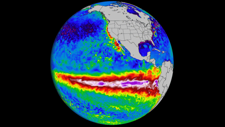
Climate systems in the Pacific are currently in a neutral phase, meaning neither El Niño nor La Niña is dominating. El Niño refers to a warming of surface waters in the central and eastern Pacific Ocean, which tends to bring drier conditions to countries like Indonesia. La Niña is the opposite pattern, with cooler waters that usually bring heavier rainfall. The neutral phase sits in between, with more stable and less extreme weather patterns.
Forecasts suggest this balance may shift in the coming months. International climate agencies indicate that the likelihood of El Niño increases by mid-2026, with uncertainty over how strong it could become.
Possible El Niño Scenarios
A mild scenario would bring a slightly drier dry season without major disruption. In this case, existing irrigation systems and food reserves would likely absorb the impact.
A moderate scenario would start to strain agriculture. Lower rainfall could disrupt planting cycles, reduce yields in key rice-producing regions, and tighten water availability in both rural and urban areas. Prices could begin to rise, especially in more vulnerable provinces.
A severe scenario would resemble past crisis years. Extended drought could trigger widespread forest and peatland fires, leading to haze across Indonesia and neighboring countries. Agricultural output would drop more sharply, and food supply chains could come under pressure.
El Niño Lessons From the Past
The 2015 episode was brutal: Fires spread across Sumatra and Kalimantan, disrupting transport, health systems, and regional air quality. According to the World Bank, 2.6 million hectares burned and the economic cost reached about $16.1 billion. That year became the reference point for how quickly drought can turn into a crisis.
More recent events have been less extreme but still disruptive. The 2023–2024 El Niño reduced rainfall in parts of Indonesia and affected rice production. FAO assessments noted below-average paddy output during that period due to prolonged dry conditions.
Globally, the same climate pattern produced different outcomes. East Africa shifted from drought to severe flooding. Parts of South America, especially Peru and Ecuador, faced heavy rains linked to coastal warming. Forecasts in India now suggest a weaker monsoon could emerge if El Niño strengthens in 2026. The pattern is consistent: the same ocean signal translates into very different local crises.
How Indonesia Is Preparing
Agriculture Minister Andi Amran Sulaiman says Indonesia is preparing by expanding pumping capacity, optimizing swampland. More than 80,000 pumps were distributed in 2025 as part of the defense, with roughly 40,000 more to be added.
Bulog and Bapanas are also stressing supply security: government rice stocks were reported at around 4.4 to 4.6 million tons in early April, while Bapanas projected surpluses in rice and corn through May.
BMKG, for its part, has warned that hotspot counts are already running above previous years and that fire risk could rise from June onward in parts of Sumatra and Kalimantan