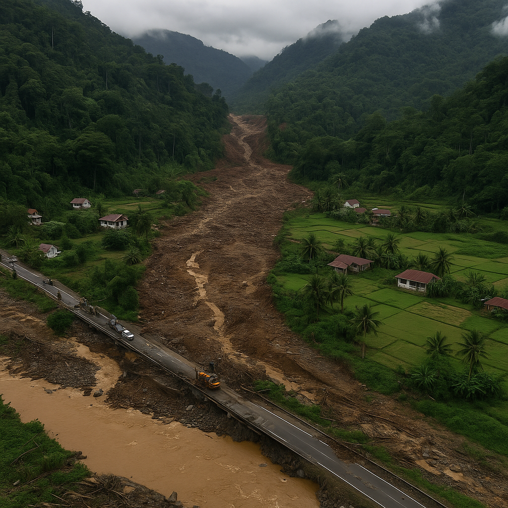
The Sumatra floods have moved the region into a difficult second stage: rebuilding damaged infrastructure while investigators sift through evidence that points to deeper problems in the island’s upstream landscapes. With the confirmed death toll now at 940, and 276 people still missing, officials across West, North and Central Sumatra are balancing urgent relief with tough questions about what turned this cyclone-driven disaster into one of the region’s deadliest events in years.
Restoring Access After the Sumatra Floods
West Sumatra’s government is focusing first on reconnecting towns that were cut off when sections of the Lembah Anai national road collapsed under the force of the water. Heavy machinery has been working almost nonstop, carving semi-permanent access routes so small and medium vehicles can pass again. The loss of the main corridor pushed traffic onto a few remaining arteries, slowing aid trucks and delaying basic supplies. Some villages remained so isolated that authorities had to shift to air and sea deliveries, supported by Army, Navy and Air Force assets. Electricity has largely returned, but several water intake facilities remain clogged with sediment from the floods.
In North Tapanuli, the isolation was severe enough that the Army deployed a Bell M-412 helicopter to airdrop food and medical items. The operation, part of a wider response directed by Army Chief of Staff General Maruli Simanjuntak, continues while engineers clear landslide points along the district’s narrow roads. Command officials said airdrops remain essential until ground access becomes reliable again.
Expanding Investigations Into Corporate Roles
As field teams work on the ground, a parallel effort is unfolding in Jakarta. Forestry Minister Raja Juli Antoni told lawmakers that 12 companies are now under scrutiny for possible violations related to upstream deforestation and river-corridor clearing. His ministry has already proposed the revocation of about 20 forest-use permits, adding to earlier cancellations that covered more than half a million hectares. The probe includes firms operating in the Batang Toru region, where environmental pressures have been rising for years.
Some names have already entered public view. PT Agincourt Resources, operator of the Martabe gold mine, said it supports the ministry’s review and is preparing data for regulators. The Indonesia Palm Oil Association (GAPKI) stated that it has not been informed of any investigations involving its members. Officials stress that no list will be final until the president signs off on the permit actions.
New Tools Reveal Patterns in the Landscape
Investigators are using a mix of aerial surveys and digital analysis to trace the path of logs swept downstream. Drone teams mapped sections of the Batang Toru and Garoga watersheds, identifying broad stretches of land clearing on steep slopes. The ministry also deployed AIKO, the Automatic Log Identification Tool, to examine the physical characteristics of timber found along beaches and riverbanks. The goal is straightforward: determine which pieces of debris came from natural breakage and which may reflect human interference.
The government has now suspended operations for several companies in the Batang Toru basin as environmental audits get underway. Officials visiting the area reported visible erosion and thinning forest cover in upstream zones, conditions that can accelerate the movement of water and sediment during extreme rainfall—an issue researchers have raised repeatedly over the past two decades.
Outlook
With more heavy rain forecast, authorities are working with BMKG on early-warning measures and possible weather-modification options. For now, the priority remains reopening communities, stabilizing supply lines and ensuring that relief reaches every isolated point. But the investigations signal that this recovery phase will not end with road repairs alone; the country appears prepared to confront the upstream pressures that turned a severe storm into an island-wide catastrophe.